Total For January
Total this month: 71.0 miles CORRECTION: 95.9 miles
posted by Dan at 11:59 PM
1 comments
![]()
![]()

You've landed on the Blogger site for Dan on Bike. This site is no longer being updated,
and all new content can be found at http://danonbike.us.
Commenting has been disabled here, but the new site is ready for your views. Please come visit.
posted by Dan at 11:59 PM
1 comments
![]()
![]()

posted by Dan at 12:50 PM
2 comments
![]()
![]()
posted by Dan at 8:36 PM
1 comments
![]()
![]()
posted by Dan at 8:20 PM
6 comments
![]()
![]()
posted by Dan at 8:48 PM
0 comments
![]()
![]()
![[WL Plant Arial Photo]](http://www.city.west-lafayette.in.us/departments/wastewater/wwtuaerial.jpg)
posted by Dan at 8:45 PM
0 comments
![]()
![]()
posted by Dan at 7:09 AM
1 comments
![]()
![]()

posted by Dan at 9:40 PM
1 comments
![]()
![]()
posted by Dan at 9:17 PM
1 comments
![]()
![]()
posted by Dan at 7:15 AM
1 comments
![]()
![]()
posted by Dan at 8:11 PM
2 comments
![]()
![]()
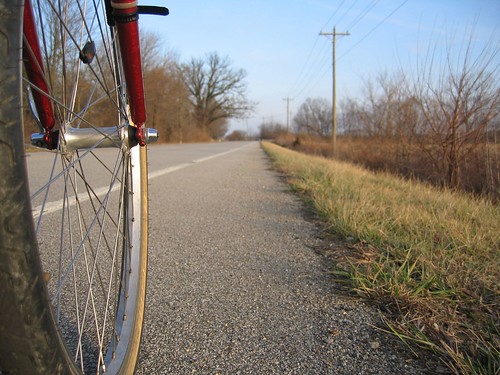
The bicycle is the most efficient machine ever created: Converting calories into gas, a bicycle gets the equivalent of three thousand miles per gallon. ~ Bill Strickland, The Quotable Cyclist
In late October 1879 Purdue chemistry professor Harvey W. Wiley began pedaling around on what may have been the first bicycle in Lafayette.
When man invented the bicycle he reached the peak of his attainments. Here was a machine of precision and balance for the convenience of man. And (unlike subsequent inventions for man's convenience) the more he used it, the fitter his body became. Here, for once, was a product of man's brain that was entirely beneficial to those who used it, and of no harm or irritation to others. Progress should have stopped when man invented the bicycle. ~Elizabeth West, Hovel in the Hills