Wabash Avenue Route
I haven't added a new route in a while, but I was looking for something to ride to the south in about an hour. So, I present the Wabash Avenue Route.
Starting from the home base at Newman and Division Roads near West Lafayette, head south to River Road. Following it east towards the Levee, turn south again onto the Branigin Bridge.
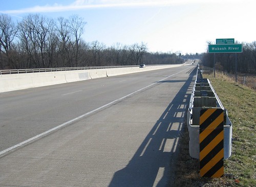
Five years later, we still call this the "new bridge"
You can see in the picture that the wide shoulder makes a great bike lane - enough for two riders to ride abreast.
At the top of the hill, take a left (east) onto SR25. This can be a tricky maneuver in traffic, so be careful! After a short distance, the wide shoulder disappears, so we have to share the right turn lane with the car types. The very next left (another tricky one) heads north on Old Romney Road to the Elston area. I tried to get a picture of the neat church on Elston Road, but the sun was behind it and it didn't work out. Maybe some other day. Old Romney Road, Beck Lane and Wabash Avenue all intersect at the top of the hill near the yard where concrete bridge members are cast.
Take another left to head down the hill on Wabash and cross under and over the various railroad tracks and pass the Lafayette Wastewater Treatment Plant. The smells bring back memories of my past career in a similar plant.
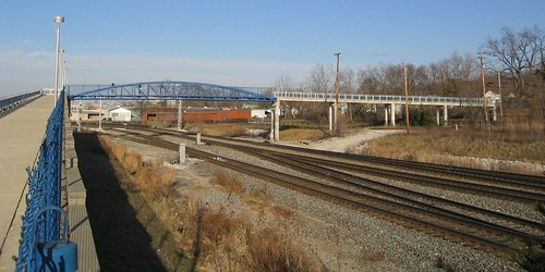
Down on "the Avenue", there is a little neighborhood area boasting a meat packing plant, a Catholic church, an old fire station (now a government office), and a Christian-themed coffee shop in a building that used to host a strip club. Here at Smith street, there was much outcry when the Rail Relocation project closed the street as all of the downtown rail lines were consolidated into one corridor. The locals were (understandably) worried that the school children would have a tough time getting over to Miller Elementary. So, the project built a monstrous pedestrian walkway over the tracks. The wheelchair ramp on the west side is a block and a half long!
Continue north on Wabash to the downtown area. At Main Street, take a left onto the Myers Pedestrian Bridge over the Wabash. This is a nice, traffic-free way to get back to the West Side.
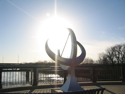
Sundial on the Myers Bridge
At the west end, turn left onto the Wabash River Heritage Trail. I've talked before about this paved trail through the woods that cuts behind the West Lafayette Wastewater Treatment Plant. (Hey! It's the second treatment plant of the route! Maybe I should call this the tour of sewage.)
![[WL Plant Arial Photo]](http://www.city.west-lafayette.in.us/departments/wastewater/wwtuaerial.jpg)
See the bike path in the lower right corner?
Back at River Road , a quick jaunt north leads to Williams Street. Power up the hill to Grant Street. A couple blocks up, turn west onto Harrison Street and pedal through the south campus area past the Vet School and Physical Plant buildings.
North on Intramural Drive passes the Purdue Police station and two Discovery Park buildings under construction. At State Street turn left (west) to head home.
State Street becomes SR 26. At Newman Road, turn left to head west-southwest and back to Division Road.
Not a bad way to spend an hour.
Starting from the home base at Newman and Division Roads near West Lafayette, head south to River Road. Following it east towards the Levee, turn south again onto the Branigin Bridge.
You can see in the picture that the wide shoulder makes a great bike lane - enough for two riders to ride abreast.
At the top of the hill, take a left (east) onto SR25. This can be a tricky maneuver in traffic, so be careful! After a short distance, the wide shoulder disappears, so we have to share the right turn lane with the car types. The very next left (another tricky one) heads north on Old Romney Road to the Elston area. I tried to get a picture of the neat church on Elston Road, but the sun was behind it and it didn't work out. Maybe some other day. Old Romney Road, Beck Lane and Wabash Avenue all intersect at the top of the hill near the yard where concrete bridge members are cast.
Take another left to head down the hill on Wabash and cross under and over the various railroad tracks and pass the Lafayette Wastewater Treatment Plant. The smells bring back memories of my past career in a similar plant.
Down on "the Avenue", there is a little neighborhood area boasting a meat packing plant, a Catholic church, an old fire station (now a government office), and a Christian-themed coffee shop in a building that used to host a strip club. Here at Smith street, there was much outcry when the Rail Relocation project closed the street as all of the downtown rail lines were consolidated into one corridor. The locals were (understandably) worried that the school children would have a tough time getting over to Miller Elementary. So, the project built a monstrous pedestrian walkway over the tracks. The wheelchair ramp on the west side is a block and a half long!
Continue north on Wabash to the downtown area. At Main Street, take a left onto the Myers Pedestrian Bridge over the Wabash. This is a nice, traffic-free way to get back to the West Side.
At the west end, turn left onto the Wabash River Heritage Trail. I've talked before about this paved trail through the woods that cuts behind the West Lafayette Wastewater Treatment Plant. (Hey! It's the second treatment plant of the route! Maybe I should call this the tour of sewage.)
Back at River Road , a quick jaunt north leads to Williams Street. Power up the hill to Grant Street. A couple blocks up, turn west onto Harrison Street and pedal through the south campus area past the Vet School and Physical Plant buildings.
North on Intramural Drive passes the Purdue Police station and two Discovery Park buildings under construction. At State Street turn left (west) to head home.
State Street becomes SR 26. At Newman Road, turn left to head west-southwest and back to Division Road.
Not a bad way to spend an hour.
posted by Dan at 8:45 PM
![]()
![]()


0 Comments:
Post a Comment
<< Home